Although the suitable habitat for krill encompasses the entire Southern Ocean, there is high spatial and temporal variability in abundance. To help vessels navigate this variability, my research group developed models that can support sustainable harvesting of krill.
Model-based decision support:
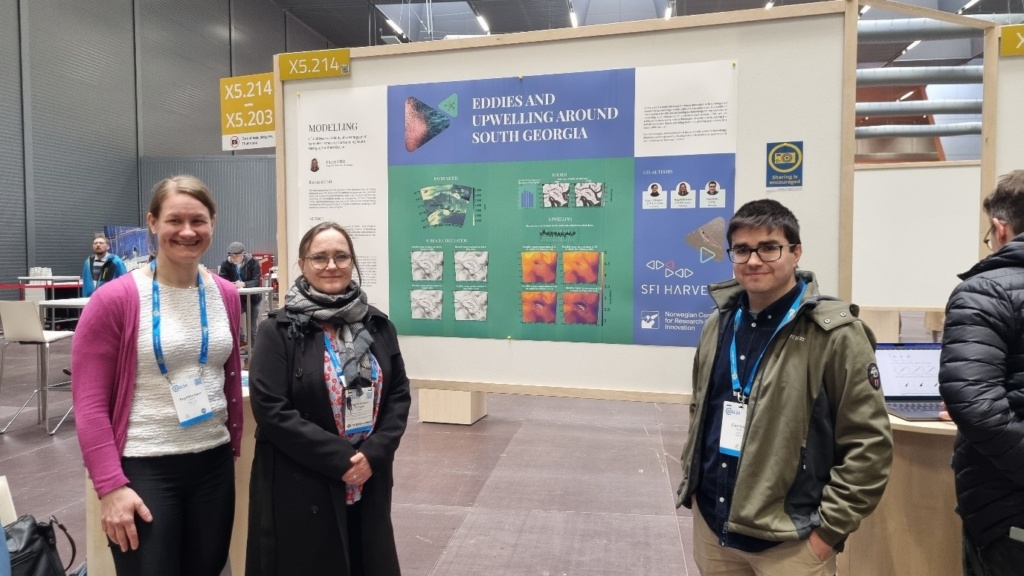
As part of the Centre for research-based innovation, SFI Harvest, my research group was tasked with providing insights to support economically and environmentally sustainable harvesting of Antarctic krill.
Beginning with a limited knowledge base in the topic at the NTNU ITK department, we managed to integrate competence from across NTNU, SINTEF Ocean, and our industry partner Aker QRILL to drive the project forward. Combining high resolution remote sensing data, ocean modelling, Lagrangian modelling (particle tracking), high-performance computing and machine learning, our project has managed to lay a pathway for model-based approaches to supporting fishing activity.
This builds on our seminal work on model-based decision support from the Fishguider project. Below, I will outline the two key insights gained from modelling studies conducted during this project:
1. Dominant transport pathways influence fishing activity
Our first key insight is that Aker QRILL could develop an index for krill catch potential in South Georgia, a highly uncertain fishing region, based on dominant transport patterns for that year.
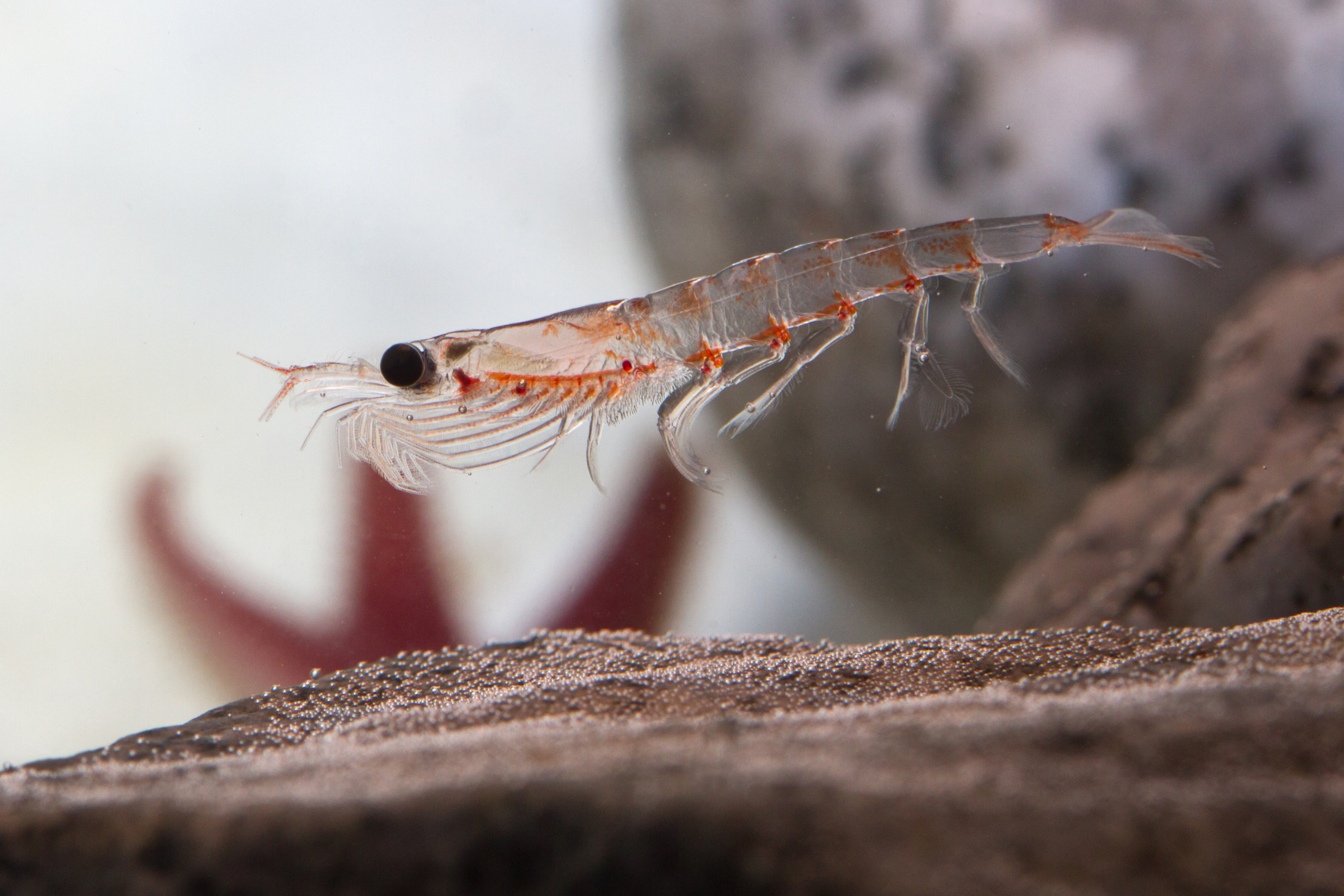
The Antarctic Circumpolar Current (ACC) is the only major ocean current that circumnavigates the globe. Coastal currents, fronts, eddies and upwelling systems associated with the ACC are crucial in determining phytoplankton and zooplankton distribution and abundance. This results in regional hotspots of krill populations, particularly in the Atlantic Sector, with the Antarctic Peninsula, South Orkney Island and South Georgia being the exclusive focus of Aker QRILL fishing operations.
Scientific studies have shown that South Georgia is a “sink” habitat for krill, with the local population sustained by advection (the movement with ocean currents) from other regions, while the Antarctic Peninsula and South Orkney Island regions are primarily a “source” habitat of krill with favourable conditions for spawning and development. Therefore, variability between years in the ACC should impact the recruitment of krill to South Georgia.
To investigate the relation between dominant transport patterns and the South Georgia winter fishery, we employed a Lagrangian modelling approach using OpenDrift, an open-source framework developed at the Norwegian Meteorological Institute. To force the Lagrangian model, we used ocean physics data from Copernicus Marine Service as input. We simulated the release every 7 days, and subsequent transport of particles from sites at the Antarctic Peninsula and South Orkney Island regions, tracking their position over 300 days for the years 2006 : 2020. This involved a lot of heavy computations, so we utilised high-performance computational resources from Sigma2. We compared statistics from model simulations to catch data over the same period from CCAMLR.
Our results show that the higher the recruitment to South Georgia, the higher the average catch values for that particular year, but only in releases from the Antarctic Peninsula. This indicates that the South Georgia krill population is particularly sensitive to transport from Antarctic Peninsula, a result that is supported by previous modelling studies. Read more about our work here: https://doi.org/10.1101/2025.02.12.637831
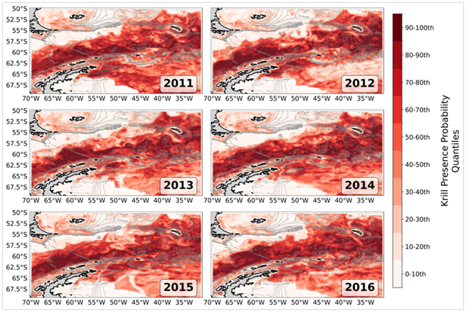
2. Species distribution modelling suggests alternative krill fishing locations:
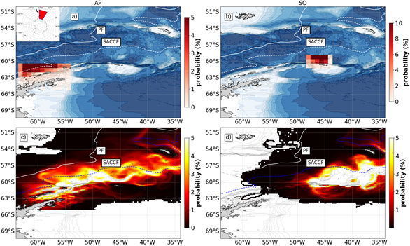
Our second key insight is that there are numerous alternative regions for the targeting of the krill fishery, particularly southern shelf-break regions off the western Antarctic Pensinsula, currently not a region of exploitation.
With a plethora of new observational data being made available through new sensors, platforms and datasets, it is an exciting time to leverage available observations to predict distribution and abundance of marine species. The Copernicus Marine Service is an invaluable catalogue of global and regional datasets.
Species Distribution Modelling involves leveraging environmental datasets with biological datasets of species to predict and explain patterns in time and space. In this work, we combined environmental variables that affect krill distribution (chlorophyll concentration, iron concentration, sea-surface temperature, sea-surface velocity, sea-surface height, bottom depth) with presence/absence data from KRILLBASE, an archive of krill data from 1976:2016. We trained a Boosted Regression Tree Model with the environmental variables as features and krill presence/absence as the target variable and predicted a probability of presence for the Atlantic Sector.
As my post-doc comes to an end, I would like to thank some of the people I have collaborated with as part of Research Area 2 in SFI Harvest. It has been an honour and privilege to work on cutting-edge, innovative research as part of an interdisciplinary team at both NTNU and SINTEF Ocean. I want to pay special thanks to my advisors: Morten Omholt Alver, Ingrid Ellingsen and Ragnhild Daae, as well as the coordinators and leaders of the SFI Harvest project.


Comments
No comments yet. Be the first to comment!