#Energy #Ocean

GoNorth discovers new hydrothermal field between Svalbard and Greenland

Research vessel Kronprins Haakon in the Arctic Ocean.Scientists taking part in the 2023 GoNorth expedition have discovered a new hydrothermal field – an area with sea floor hot springs – in the Lena Trough, part of a mid-ocean ridge between Svalbard and Greenland.

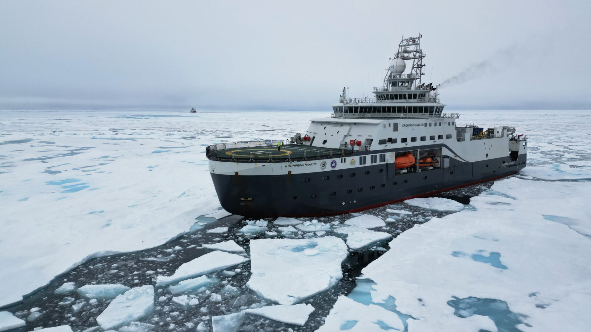
The expedition came to a successful conclusion despite an incident a few days in that forced the ship to go to Tromsø for repairs.

Black smoker at Lucky Ridge.
These hydrothermal chimneys had never been seen by human eyes before. They are of a type called black smoker, because the hot water they spew out has been rendered black by chemical interactions with rocks. Photo: Ægir 6000/NORMAR/UiB

A long search

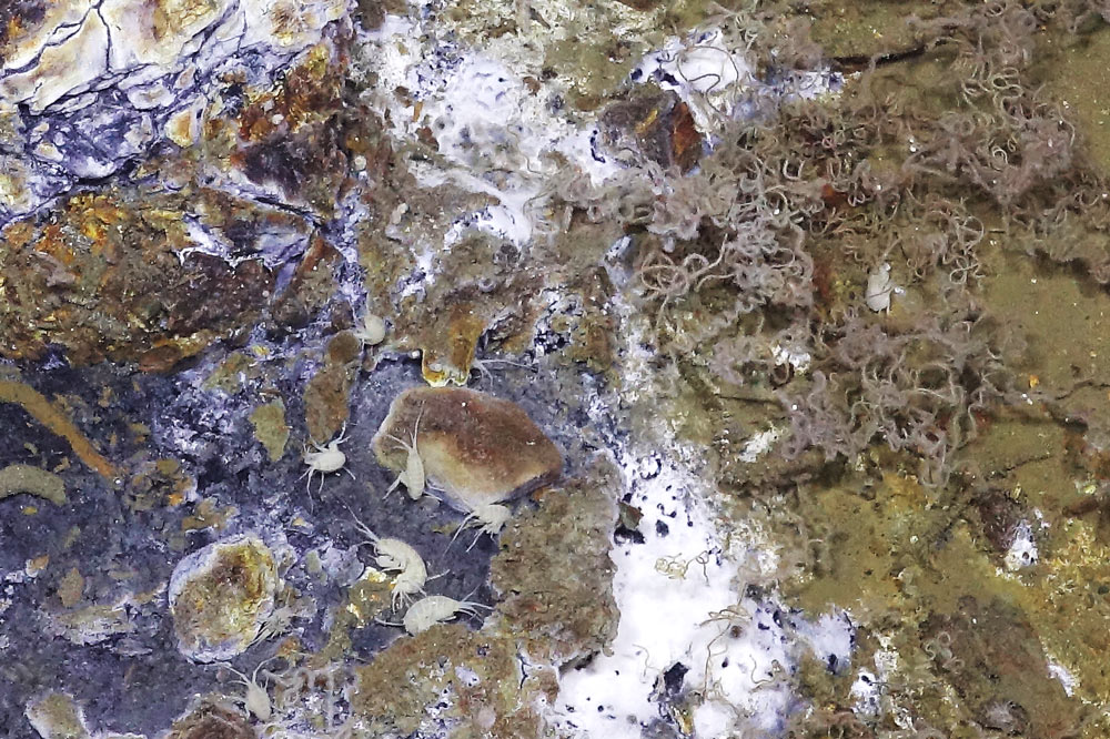
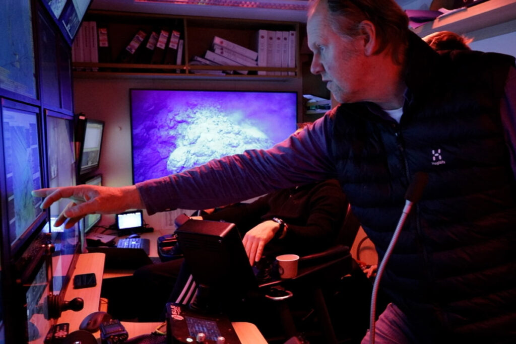
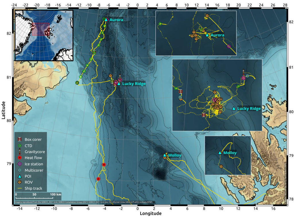
Research vessel Kronprins Haakon spent nine days scouring the Lena Trough with a remotely operated vehicle (ROV) for signs of hydrothermal activity. The ROV found many such signs: minerals produced by hydrothermal activity, fauna commonly associated with these areas, and hot water coming out of the sea floor.

Image showing the seafloor and various lifeforms living there.
Certain types of fauna are commonly found near hydrothermal vents. Left of centre, the shrimp-like creatures you can see are called amphipods. The curly threads on the right are tubeworms. The white part most likely consists of a mix of bacteria and minerals – yet another telltale sign of hydrothermal activity. Photo: Ægir 6000/NORMAR/UiB

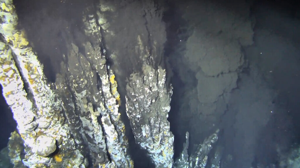
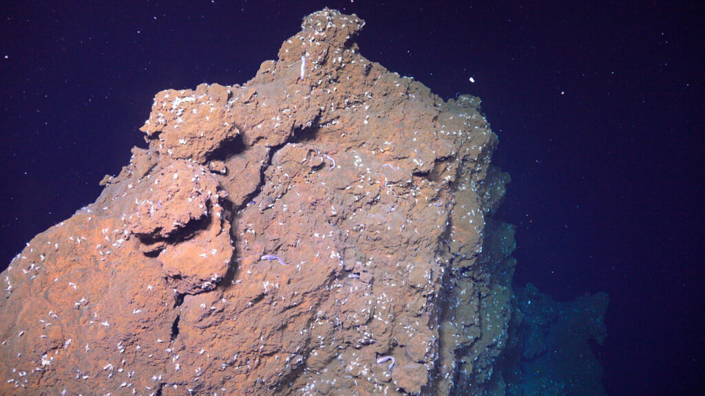
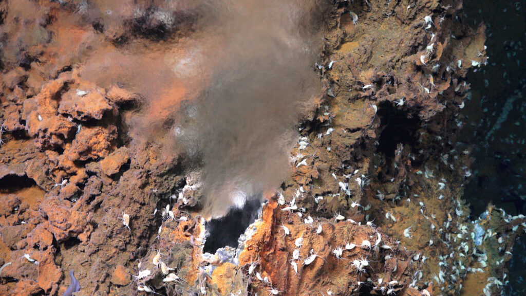
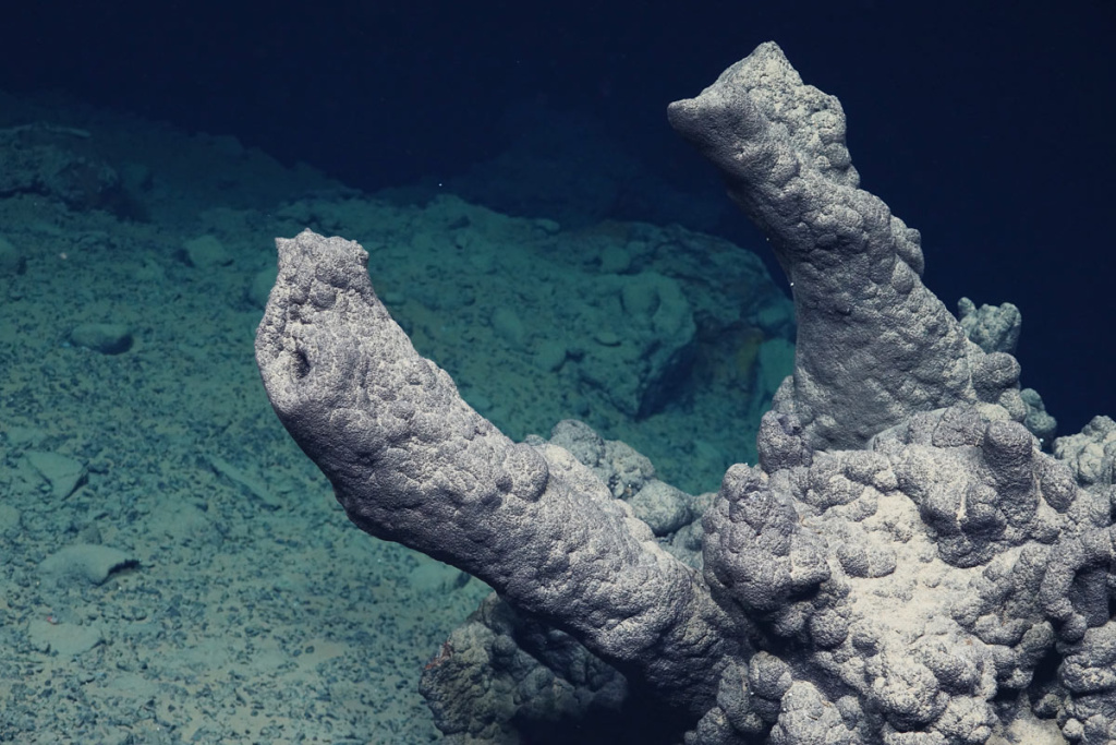
At first, the springs (geologists call them “vents”) found by the ROV were of the shimmering kind; these spew out crystal-clear water, which makes them visible on video because they cause a shimmer in the water, but almost impossible to see on still images. The holy grail of hydrothermal activity, though, is the black smoker: these vents spew out hot water (sometimes as hot as 400°C) turned black by chemical interactions with underground rocks.

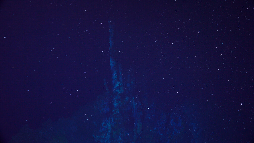
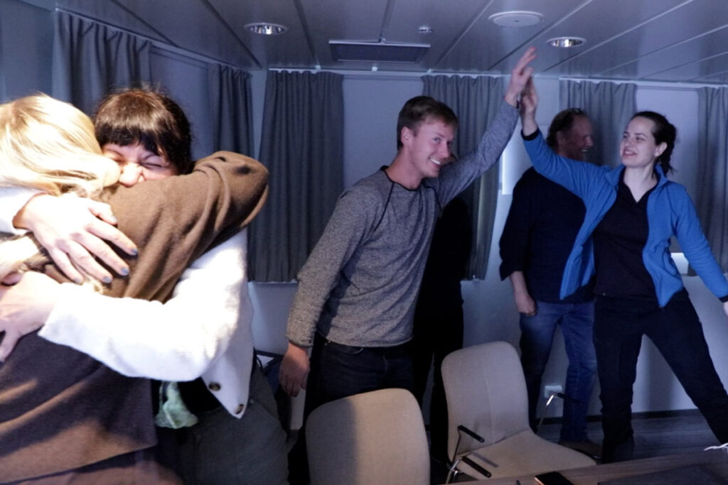
Hydrothermal vents are often associated with tall, chimney-like structures created by the outflow of chemically laden water. Scientists found several inactive chimneys during their search. Late at night, on what was slated to be the ROV’s very last dive of the expedition, they found one that was very much active and estimated to be as much as 10 metres tall.

Geological structure covered in amphipods.
Just before coming to the chimney, the ROV filmed this sulphide structure. It is covered in amphipods, shrimp-like creatures enjoying the hydrothermal warmth and chemical nutrients in the fluids. Photo: Ægir 6000/NORMAR/UiB
Image showing the moment at which scientists saw a new black smoker for the first time.
This is the moment the scientists saw the chimney for the very first time. It is dark down in the deep, and the ROV needs to get quite close to be able to see anything. Photo: Ægir 6000/NORMAR/UiB
Hydrothermal vent with amphipods.
At another location in the same vicinity, hot water that had not changed colour to black was coming out of the rock. The colour change is the result of chemical reactions between the water and the rocks below the seabed. Photo: Ægir 6000/NORMAR/UiB
Image showing scientists celebrating after a discovery.
Hugs and high fives in RV Kronprins Haakon’s conference room after the discovery of the black smoker. Left to right: Maja Jæger (UiB), Sabina Strmic Palinkas (UiT), Håvard Stubseid (UiB), Rolf Birger Pedersen (UiB) and Eszter Sendula (UiT).

Building on previous results

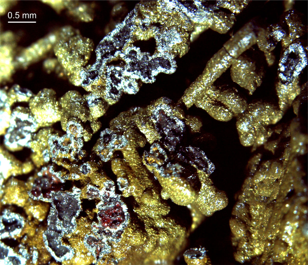
It was known that there was hydrothermal activity in this particular area (called Lucky Ridge) since 2004. That’s when German research vessel Polarstern dredged up some rocks rich in sulphides, which suggests that they were hydrothermal mineral deposits. They also registered temperature anomalies in the water column; another sign that hot water is coming up from the sea floor somewhere in the area.

Lucky Ridge is a 1600-metre-tall subsea mountain (the same height as Trollveggen), sitting in a 4000-metre-deep valley. GoNorth explored it extensively over the past days. Scientists not only found several active sites but created a detailed seafloor map of the area with the ROV. In total, over 100 samples have been collected (80 in the Lucky Ridge area), and their analysis over the coming months will shed even more light on the geological characteristics of the new vent field.

Underwater image showing an inactive hydrothermal chimney, covered in a manganese crust.
An inactive chimney discovered earlier during the expedition. It has an unusual look, according to the geologists on board. It also has a thick manganese crust, which suggests it’s been inactive for a while. Photo: Ægir 6000/NORMAR/UiB

“At first glance, this seems like a very special field,” says expedition leader Rolf Birger Pedersen. “It has many traits that differentiate it from similar areas other places around the world.”

These differences will no doubt be explained as the scientists carry out their analyses over the coming months. Rolf Birger Pedersen expects the area to get a lot of attention, moving forward.

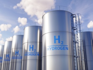
“Lucky Ridge is composed of mantel rock that are normally covered by the crust. Reactions between the mantel minerals and seawater leads to the release of hydrogen, which is a source of energy for certain types of microorganisms. These microorganisms are in turn a source of food for other, bigger creatures. The areas mapped by GoNorth can become a living laboratory for the study of this interplay between life, water and minerals.”

Expedition leader Rolf Birger Pedersen (UiB)
Expedition leader Rolf Birger Pedersen (UiB) at work in the ROV’s control room.
Microscope image of a rock sample.
Microscope image of rich copper mineralisation that suggests the temperature of the hydrothermal flow that created it was above 300°C. Photo: Sabina Strmic Palinkas (UiT)

Watch the GoNorth 2023 video

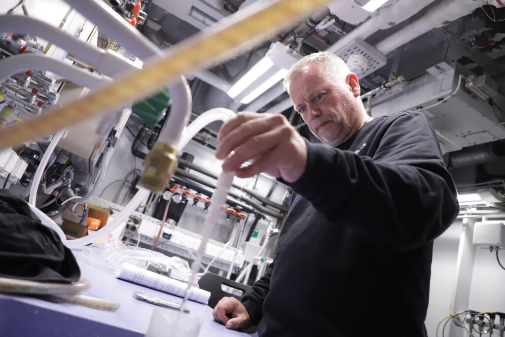
Damaged instrumentation

On 10 July, just three days after setting out from Longyearbyen, the expedition was hit by an unfortunate incident. A steel rod holding a crucial positioning device underneath the hull of the ship was bent when it was hit by sea ice. Kronprins Haakon had to go to Tromsø for repairs, at reduced speed, which amputated the research time by several days.

The repairs were carried out quickly thanks to the good work of the ship’s crew, with support from Maritim Sveiseservice for crane operations, Fagdykk for the diving operation needed to remove the bent steel rod, and Kongsberg Support for rapidly sending a spare part to Tromsø.
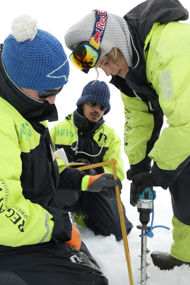
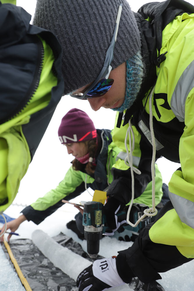
Heavy sea ice

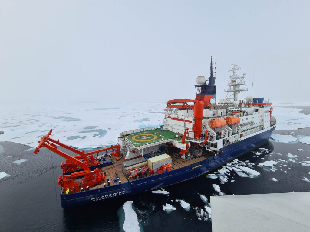
Unusually heavy ice conditions – when compared to recent years at least – meant that the ship was unable to reach the Nansen and Amundsen Basins, where some research activities were planned. Even German research vessel Polarstern, a heavier, more powerful icebreaker than Kronprins Haakon, struggled in these conditions. This is how the expedition came to spend more time than initially planned in the Lena Trough.

Collaboration with Polarstern

Even though sea ice dictated where the ships could be, the planned collaboration between Norwegian vessel Kronprins Haakon and German vessel Polarstern was carried out. The ROV picked up an ocean-bottom seismometer that Polarstern had not managed to release from the sea floor. Polarstern in turn provided coordinates to interesting areas in both the Aurora vent field (where the ships met) and in the Lucky Ridge area.

German research vessel Polarstern
German research vessel Polarstern. Photo: Daniel Albert GoNorth/SINTEF

A multidisciplinary expedition

GoNorth’s objective is to push the boundaries of knowledge about Norway’s neighbourhood in the Arctic Ocean, from the sea floor and subsea geology to the sea ice, via the water column. As such, a diverse group of scientists with various areas of expertise have participated in the expedition.

Katja Häkli (NORCE) samples the top layer of a sediment core.
Katja Häkli (NORCE) samples the top layer of a sediment core. The sample will be subjected to a DNA analysis at a later stage. The goal is to create a database of DNA found in seafloor sediments, based on samples collected at a large number of locations. The end goal for the database is to create estimates of historical sea ice conditions in the Arctic Ocean. The thought is that certain species prefer ice, while others do not. Ancient DNA found in the seabed can act as a proxy (a clue) about past ice conditions. Photo: Daniel Albert GoNorth/SINTEF
Bjørn Runar Olsen (UiT) is at work in a small lab on board RV Kronprins Haakon.
Bjørn Runar Olsen (UiT) is at work in a small lab at the bottom of the ship, on deck 1. There is a sea water intake in that lab, and the goal is to filter 500 litres of water through a special capsule that accumulates traces of pharmaceuticals and personal care products. The capsule is now frozen and will be analysed in a lab in Trondheim. Photo: Daniel Albert GoNorth/SINTEF
Scientists working on sea ice.
When two ice floes collide, ridges appear. They are visible to satellites equipped with various sensors. But how do we connect the data from a satellite with the reality at sea level? And how do ridges develop during the course of a melting season? These are the questions Renée Mie Fredensborg Hansen (NTNU/DTU), pictured above, and Alexandra Pliss (NTNU), pictured below, are attempting to answer. Also pictured above: Christian Katlein (AWI) and Nabil Panchi (NTNU). Photo: Daniel Albert GoNorth/SINTEF
Scientists working on sea ice.
Alexandra Pliss and Oskar Gjesdal Veggeland (both from NTNU) measure the temperature of an ice core they just retrieved. Photo: Daniel Albert GoNorth/SINTEF
Yannick Kern (Norsk Polarinstitutt) measures a water sample's salinity in one of RV Kronprins Haakon's labs.
Yannick Kern (Norsk Polarinstitutt) measures a water sample’s salinity in one of the ship’s labs. The water’s salinity, together with its temperature, can tell us about its origins – if it’s coming from the Atlantic, for example. Salinity is particularly interesting in the Arctic Ocean because ice, when it freezes, releases salt in the water. Water that contains more salt is heavier, so it sinks to the bottom. This helps transporting nutrients between the various levels of the water column, which is important for the local ecosystem. Photo: Daniel Albert GoNorth/SINTEF
Map showing the locations of all scientific activities during the expedition.
This map shows the locations of all scientific activities during the expedition. Imagery reproduced from the GEBCO_2021 Grid, GEBCO Compilation Group 2021 (doi:10.5285/c6612cbe-50b3-0cff-e053-6c86abc09f8f), map layout by Yannick Kern (Norsk Polarinstitutt)

Next up: Morris Jesup Rise

GoNorth’s third expedition is slated to start in September of 2024, with the goal being Morris Jesup Rise, an underwater projection of the Northern Greenland shelf into the Arctic Ocean.

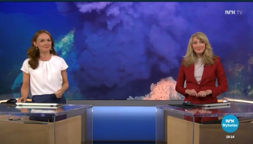
GoNorth on Dagsrevyen

GoNorth was featured on NRK evening news show Dagsrevyen, on 18 August. You can watch the segment (in Norwegian) here: Unike havbilder

Image: NRK

0 comments on “GoNorth discovers new hydrothermal field between Svalbard and Greenland

Leave a Reply

Your email address will not be published. Required fields are marked *