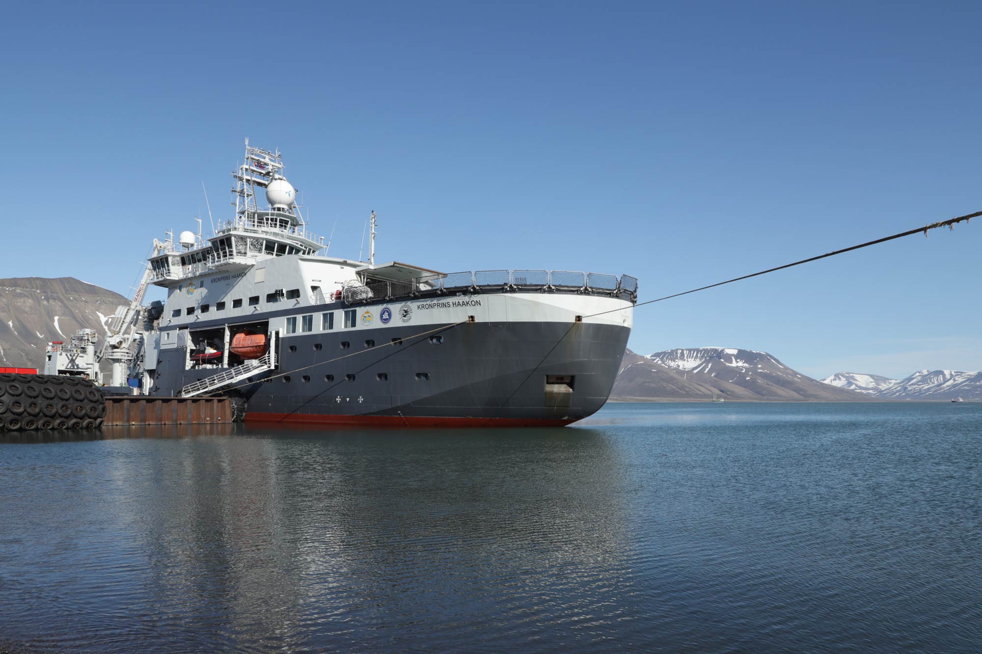
The second GoNorth expedition launches from Longyearbyen 6 July. The main goal is the exploration of the Gakkel Ridge, the mid-ocean ridge located between Svalbard and the North Pole. The expedition is a unique collaboration between Norwegian research vessel RV Kronprins Haakon and its German counterpart Polarstern.
As we are writing these lines, Kronprins Haakon is being loaded with the tonnes of equipment necessary to collect the required samples and data. Adjustments made after the first expedition mean that this year, even science teams that are not represented on board will get data and samples from the trip, collected on their behalf by engineers on board.
Knowledge about the Arctic Ocean
GoNorth’s objective is to push the boundaries of knowledge about Norway’s neighbourhood in the Arctic Ocean, from the sea floor and subsea geology to the sea ice, via the water column. To the uninitiated, the Gakkel Ridge appears on maps as a sort of underwater mountain range that extends about 1800 kilometers, in a roughly straight line, from the northern end of the Fram Strait towards Siberia.
To geologists and geophysicists, the Gakkel Ridge is known as a ultra-slow spreading mid-ocean ridge. In essence, tectonic plates on either side are moving away from each other, but very slowly compared to other mid-ocean ridges. Because it is covered with ice, we know very little about it. That alone is enough to make it interesting.
Professor Jan Inge Faleide, from the University of Oslo, has been involved in GoNorth since the very beginning:
“GoNorth will build on the limited knowledge acquired about the Gakkel Ridge 20 years ago, when a two-ship expedition conducted a detailed bathymetric survey (essentially mapping the water depth and sea floor) and took samples by dredging the ocean bottom,” he says.
Scientists have reasons to get excited about the anticipated results of this expedition: with RV Kronprins Haakon’s support, Polarstern will conduct a seismic survey of the ridge, which will provide information about its composition all the way down to the mantle. A seismic refraction survey such as the one that will be carried out on the Gakkel Ridge uses sound waves which bounce back and get registered by ocean bottom seismometers placed on the ocean floor. The reason two ships are needed is that seismic surveys are typically carried out in a straight line and at a constant speed, which is easier said than done when the entire area is covered in ice.
As in the first GoNorth expedition, the University of Bergen’s remotely operated submersible Ægir 6000 will be a part of the survey. This time, it will explore the Gakkel Ridge with its sensors and cameras, looking for hydrothermal vents, among other things, and collecting samples.
“What’s great about the samples collected by a ROV such as Ægir 6000 is that you know exactly where they’re from, says professor Faleide. With dredging samples, you know that they come from a specific line, but you don’t know exactly where every piece of material is from. With an ROV, you get exact coordinates.”
Samples from the hydrothermal vents themselves can also shed light on the structures’ history. Very small quantities of water trapped inside crystals in the rocks that shape these vents contain information about past temperatures and pressure conditions. Scientists from UiB and UiT will be on the lookout for such vents during the trip.
Norway’s new shelf in the Arctic Ocean
In 2009, the UN’s Commission on the Limits of the Continental Shelf granted Norway’s territorial claims on its northernmost shelf. Norway’s claim was based largely on the area’s geology, and on observations carried out by a group of scientists including professor Faleide. With this increase of Norway’s territorial waters comes an increase in the country’s management responsibilities of the water column.
The Gakkel Ridge itself falls outside of Norway’s extended territorial waters, but learning about it will tell us more about the origins of this new Norwegian shelf, says professor Faleide.
A priority for the Norwegian government
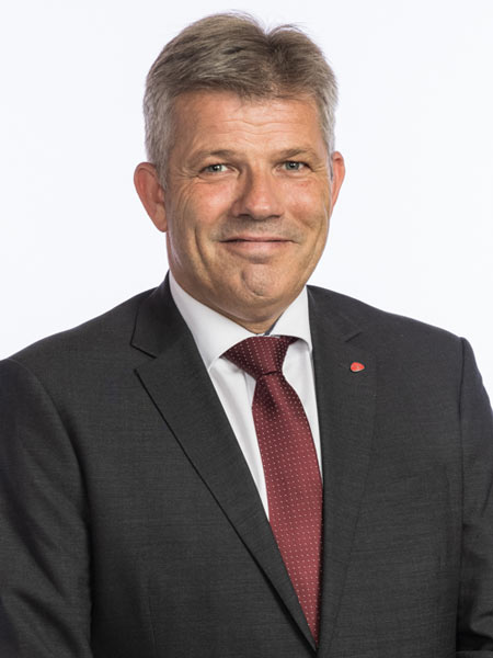
For the Norwegian government, the Northern areas are the country’s most important strategic focus area. The Minister of Fisheries and Ocean Policy Bjørnar Skjæran explains why:
“GoNorth is both important and exciting, and that is why the government has prioritised this project since 2021. Norway is a leading maritime and polar nation – both in the north and in the south. Our research, presence and activity in the High North is about safeguarding Norway’s interests. Climate change also demands that we strengthen our knowledge in several scientific fields. The list is long, and GoNorth contributes to our understanding of the sea, geophysics, biology, oceanography, and more. It is evident to me that strengthening the knowledge of our “neighbourhood” is a fundamental national interest. There are still knowledge gaps, and we plan to close these, in part through the research that is underway through GoNorth. This is also an important element of our policy for the northern region”, says Bjørnar Skjæran.
The government wishes to increase our knowledge in cooperation with other countries.
“GoNorth, through its research, makes important contributions to the work being done internationally on sea, climate and the environment, says Bjørnar Skjæran. It’s very positive that several countries are participating in this initiative. These are good partners with whom we have positive experiences of working together, like our Nordic neighbours, Germany and the USA. Cooperation with these countries is crucial to our success.”
After the current GoNorth expedition is over, work will continue towards planning a third one in 2024.
The water column and the sea ice
Geology and geophysics are focus areas of this expedition, but the sea ice, the water column and the biology of the sea floor sediments will also feature among this expedition’s targets. NORCE is looking for sediment DNA use as clues to determine what the sea ice conditions were in the distant past. They will also collect samples to map out deep ocean biodiversity.
SINTEF will be looking for traces of pharmaceuticals and personal care products in water travelling to the Arctic Ocean from the Atlantic. UiT will be collecting samples to identify benthic fauna (that is, organisms that live in the sediments of the sea floor). The Norwegian Polar Institute will be looking for forams (single-celled organisms protecting themselves with a tiny shell). These are well-known organisms that can give us information about past ocean conditions, but they are not very abundant in the Arctic.
Akvaplan-niva will be getting samples of environmental DNA from the water column. This is genetic material shed by organisms, and it gives a picture of the types of organisms present in an area. NTNU will be looking at sea ice. How to measure it, how to use AI to interpret sea ice images and sensor data, and how to predict the frequency of rare ice events; such as large pieces of drift ice floating down to the area off the coast of Northern Norway.
NTNU’s participants are PhD candidates, which exemplifies one of GoNorth’s objectives: to help educate the experts of tomorrow. NTNU Professor Knut Høyland explains it this way: “An important aspect of expeditions like these is that they give people a hands-on, intuitive feel of what they are working with. When you’re on campus using a computer to model sea ice, a difference of 1 centimetre in thickness might feel important, but once you get to an ice floe, you realise it’s more or less meaningless.”
The expedition is slated to last a whole month, returning to Longyearbyen on 7 August.
GoNorth is led by research institutes SINTEF and NORCE.
Read more: Follow this year’s expedition via the Daily reports from GoNorth 2023 (The reports will be in Norwegian but there will be occasional roundups in English).


Comments
No comments yet. Be the first to comment!