
Siân Evans is a postdoc with the Norwegian CCS Research Centre (NCCS) at the Department of Geosciences at the University of Oslo. In September 2023, she travelled to South Australia through the NCCS Mobility Programme to study exposed onshore salt structures as part of the effort to enable long-term subsurface CO2 storage.
There aren’t many places further from Norway than Australia, so it may sound strange that investigating rocks down under could help us to better understand Norway’s offshore geology. But despite their great distance, some key exposures in the outback of South Australia hold important clues that could allow us to de-risk potential CO2 storage sites in the southern Norwegian North Sea.
Secrets of Salt Structures
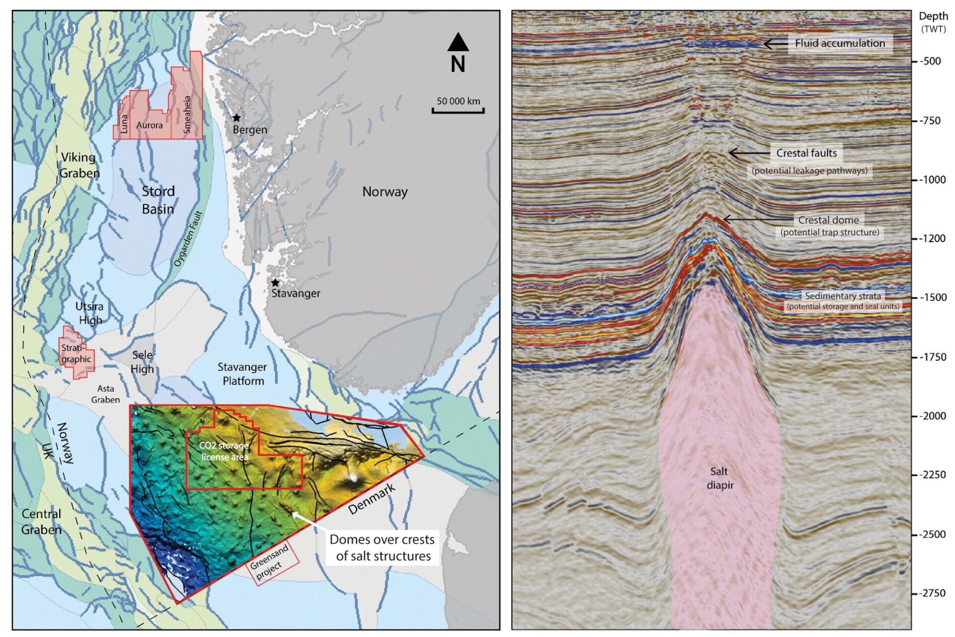
Norway’s offshore basin on the border with Denmark (the Norwegian-Danish Basin) has the potential to be a future European hub for CO2 storage. It has a convenient location, close to industrial hubs in northern Europe, as well as large theoretical storage capacity in saline aquifers, and few well penetrations from oil and gas activities.
However, both the deposition and subsequent deformation of the potential storage complexes are affected by a thick underlying layer of salt. This means that at some stage in its geological history, the basin was isolated from the global ocean, allowing enough sea water to evaporate that salt crystals precipitated from the brine and accumulated on the sea floor. The significance of this may not be immediately obvious, but these salt deposits have a profound impact on how basins subsequently develop over geological time. In contrast to other brittle rock types that usually fill a basin, such as sandstone, the unique properties of salt enable it to flow under pressure, deforming like a viscous fluid on geological timescales and creating large and complex structures. In the Norwegian-Danish Basin, these structures provide promising potential storage sites for CO2. However, their high level of complexity may also affect the flow of CO2 in unexpected ways. We must reduce this uncertainty as much as possible to ensure long-term subsurface storage. Since these structures are located several kilometres offshore and several kilometres underground, we can only analyse them using remote sensing techniques such as seismic imaging, which are limited in their information and resolution.
A Window into the Unknown
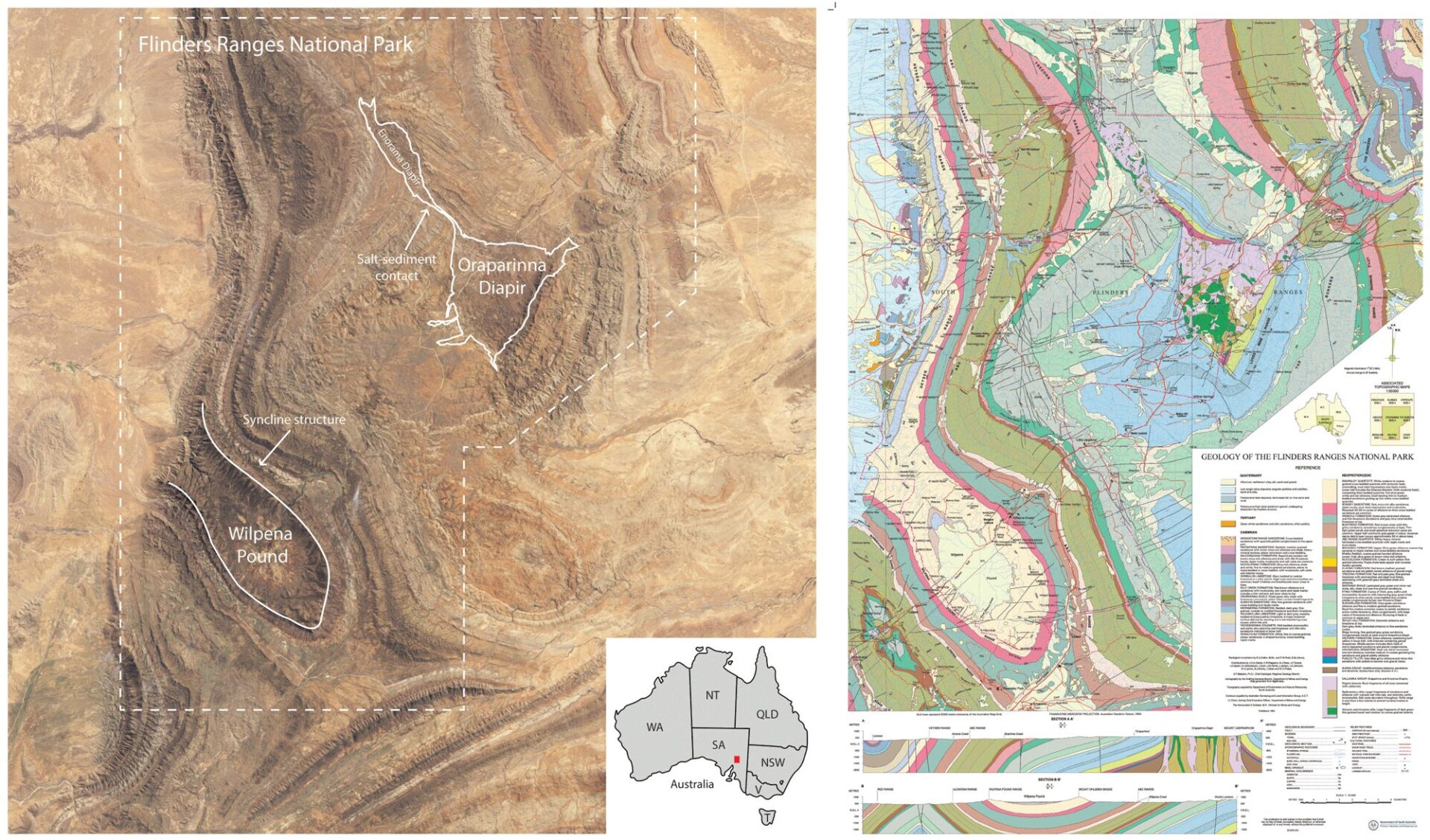
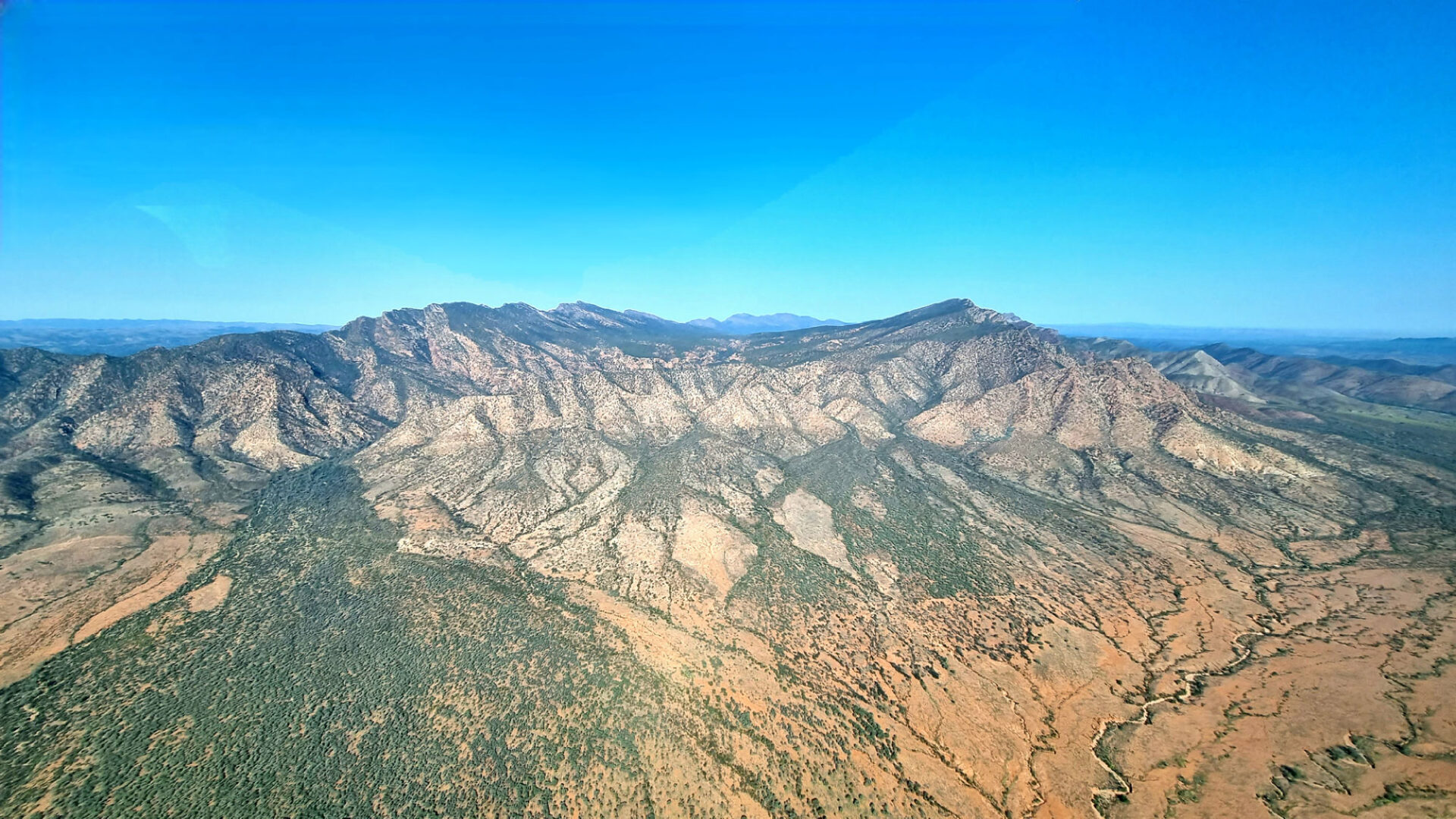
However, there are other places in the world where salt structures are exposed onshore, allowing geologists direct access to characterise the complexity of the structures and their interaction with surrounding sediments at a much greater level of detail. The Flinders Ranges in South Australia is one such area.
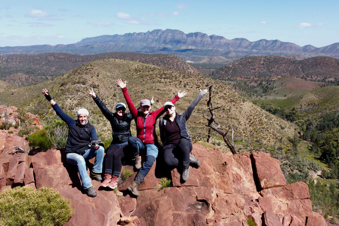
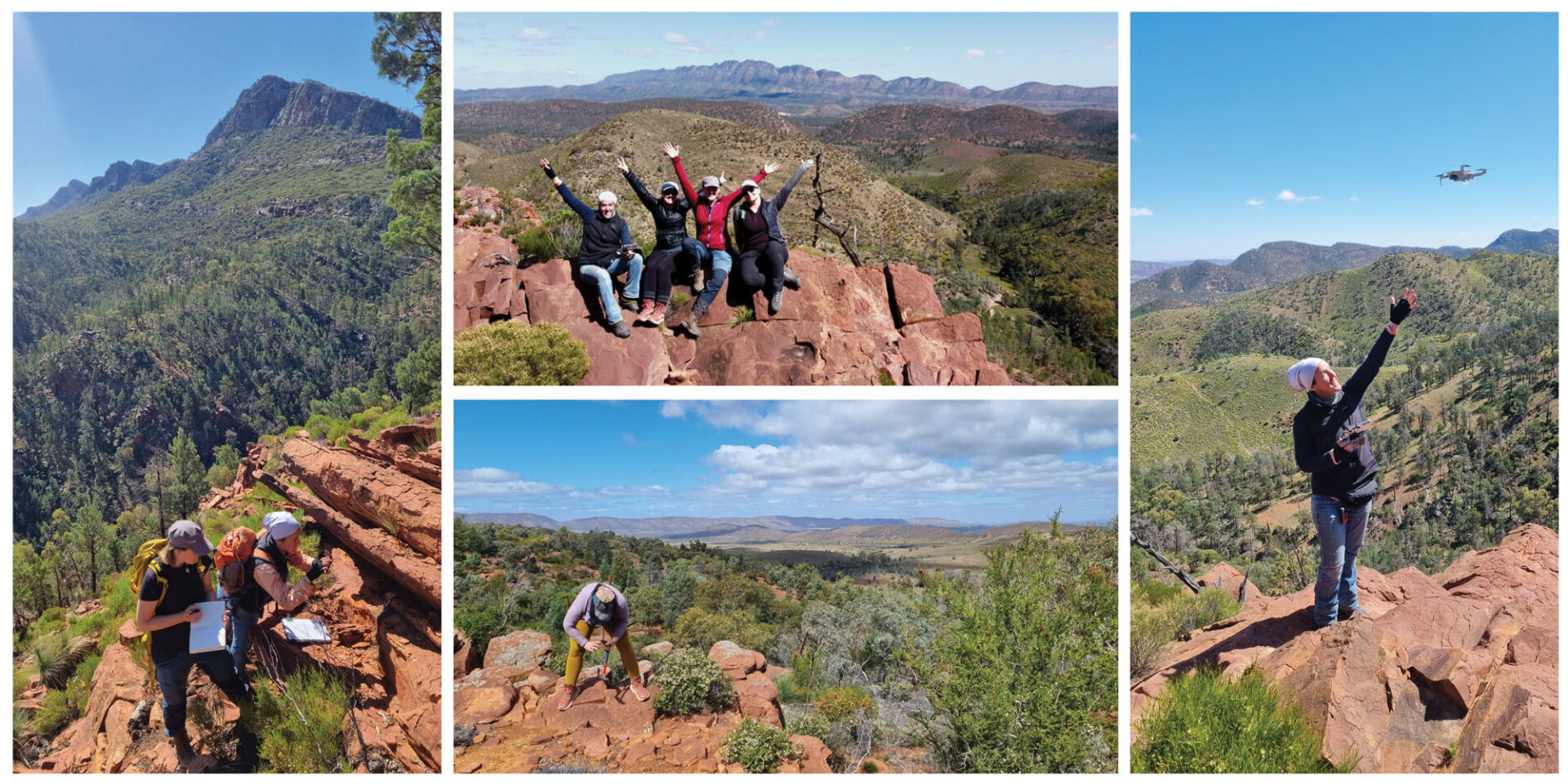
The semi-arid landscape of the Flinders Ranges, with relatively little vegetation and characteristic red tones of the outback, has ensured that geological successions are abundantly exposed and highly accessible for research. So it was there that my field team and I worked for several weeks in September 2023, where we were able to examine features at a level of detail that we would never have been able to achieve using the seismic imaging techniques that we use to map offshore structures.
The Ikara-Flinders Ranges National Park is a protected area that hosts world-class geological heritage, best known for its “golden spike”, which defines an important era of geological time right at the dawn of life on Earth. But when we descended on these ancient rock formations, the golden spike was merely a tourist stop. Instead, our attention was focused on the impressive cliff faces exposing the regionally folded sedimentary layers, as well as the low-lying mounds that represent the exposed cores of the salt structures.
Beyond the Tourist Trail
From our base in Blinman, a tiny, remote former mining village, we headed out each day to collect data around the salt structures and their overlying sedimentary layers. The field team consisted of two of my colleagues from the University of Oslo, Dr. Ingrid Anell and Leticia Rodriguez-Blanco, and our local host and regional expert from the University of Adelaide, Dr. Rachelle Kernen.
We collected various types of data, including sedimentary logs, aerial photogrammetry using a drone, samples of rocks for later lab analysis, detailed outcrop descriptions and structural measurements. We also encountered many curious locals in the form of kangaroos, emus, echidnas, lizards and spiders (luckily not the dangerous type, though none were particularly happy about the disturbance).
Collecting Clues around the Oraparinna Diapir
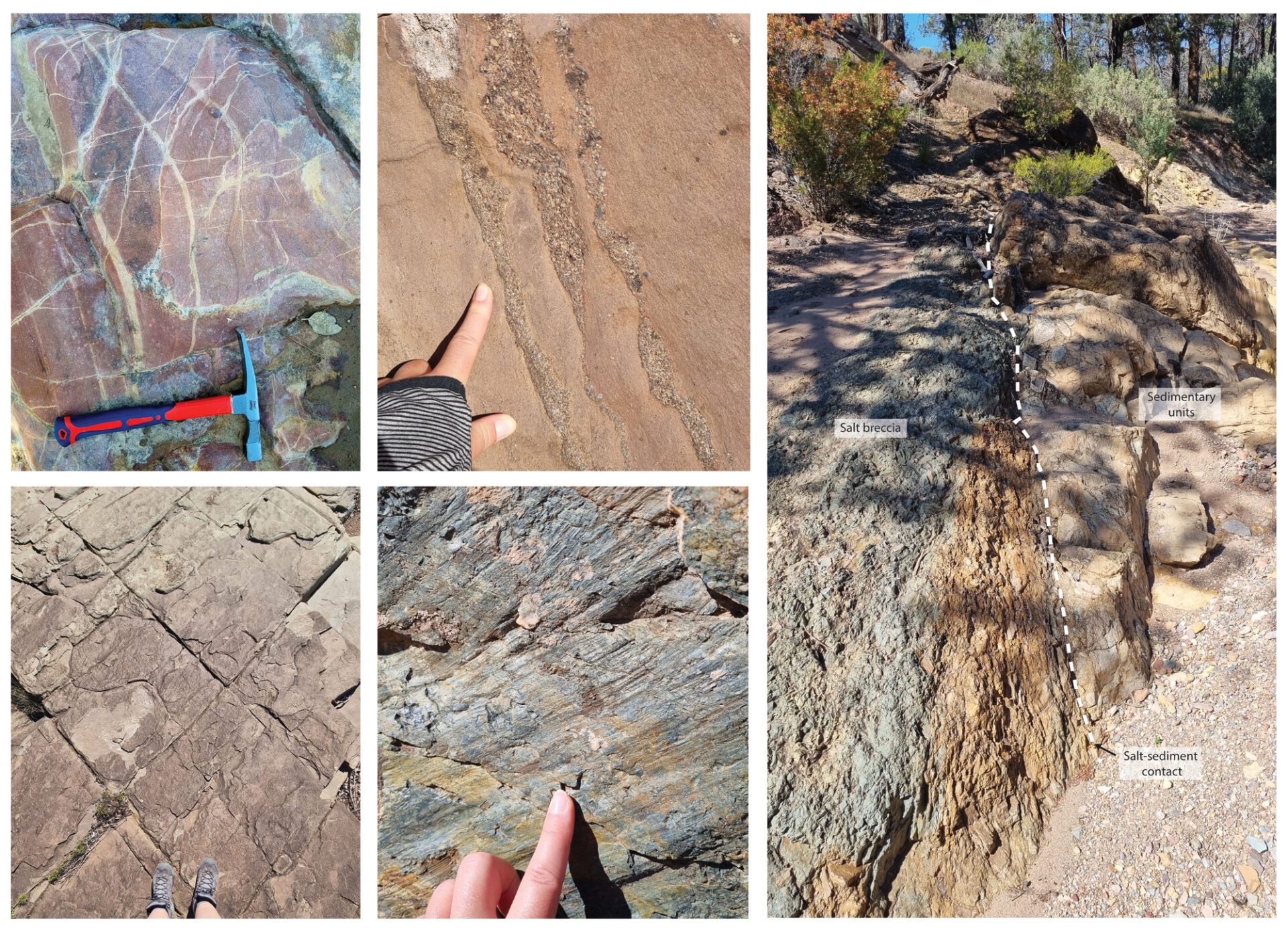
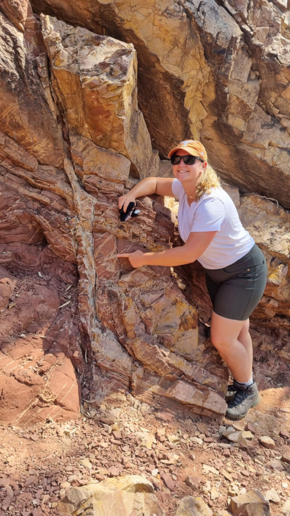
The Oraparinna Diapir is one of many exposed salt structures in the Flinders Ranges, allowing us to examine the contact between the salt and surrounding sedimentary layers. By walking up a dry creek, we traversed a section in the flank of the diapir, observing lithological changes with increasing proximity to the salt core, and eventually reaching the salt-sediment contact itself.
Some of the noteworthy observations we discussed include bleached fractures and gravel lenses in the sandstone units, both of which indicate that fluid flow in storage units will be highly perturbed around the diapir. We also observed conjugate fractures and faults in the shale-dominated successions, which indicate increased leakage risk to sealing units that have been locally deformed by salt movement.
Wilpena Pound: A Geological Marvel
After a couple of weeks traversing salt structures and deciphering sedimentary layers on the ground, we took to the skies in a tiny aircraft to collect a final round of aerial data. Our flight path traced the contours of the spectacular landscape, soaring over the paths we had trekked on foot. The most spectacular sight dominating the skyline was Wilpena Pound, a natural amphitheatre sculpted over eons of geological time. The dramatic synclinal shape of the structure is testament to the great tectonic forces that shaped this land. As we flew low around the eInternormous structure, close enough to trace the exposed sedimentary layers in the cliff faces, the scale of the ancient landscape we had spent the last few weeks exploring was all the more striking.
Enabling the Energy Transition
Geological research such as this remains at the forefront of the energy transition, as the world grapples with the urgent need to reduce global CO2 emissions. As well as holding huge potential for permanent CO2 storage, salt basins provide numerous other opportunities to enable clean energy systems, such as energy storage in salt caverns, geothermal energy development, critical mineral exploration, and natural hydrogen production.
Ongoing research into salt basin characterisation, and particularly the influence of salt tectonics on subsurface fluid flow, holds the key to unlocking these sustainable energy systems. By delving deeper into these geological wonders, we can pave the way for a greener future.


Comments
Trev J. Mount
18. June 2024 at 07:23
Sian,’
Do refer to “DEM Report Book 2021/00006 “Diapirs and diapirism in the Adelaide ‘Geosyncline’, South Australia”.
R. Kernen will have a copy, with comment; especially notes on the “Arkaba Breccia Intrusion Model” which downplays ‘GoM’ affinities!